
Landforms in Virginia (Part 1)
Virginia’s physiographic provinces (Coastal Plain, Piedmont, Mesozoic Basins, Blue Ridge, Valley and Ridge, and Appalachian Plateaus) contain different landforms that help distinguish them.
Coastal Plain
• The Coastal Plain is a gently seaward-sloping surface of very low topographic relief. The maximum elevation is about 500 feet near the Fall Line on the western edge.
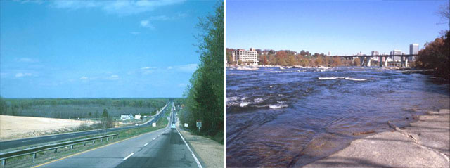
Left: Coastal Plain east of Richmond is dominated by a flat landscape; right: igneous rocks that form rapids
in the James River in Richmond is in the Piedmont. (Photographs by Robert Whisonant)
 Left photograph shows the relatively featureless Coastal Plain surface east of Richmond. Right photograph shows the rapids on the James River at Richmond that mark the western edge of the Coastal Plain. Igneous rocks in the Piedmont form the rapids in the river.
Piedmont
• The Piedmont is made up of low hills and shallow valleys. Its surface also slopes eastward. It has a maximum elevation of about 1500 to 2500 feet on its peaks.
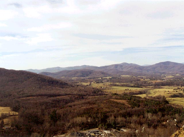
Piedmont landscape in Albemarle County (Photograph by Stan Johnson)
 Piedmont literally means foothills. This photograph shows the foothills of the western Piedmont in Albemarle County.