|
|
|
|
|
|
|
|
|
|
|
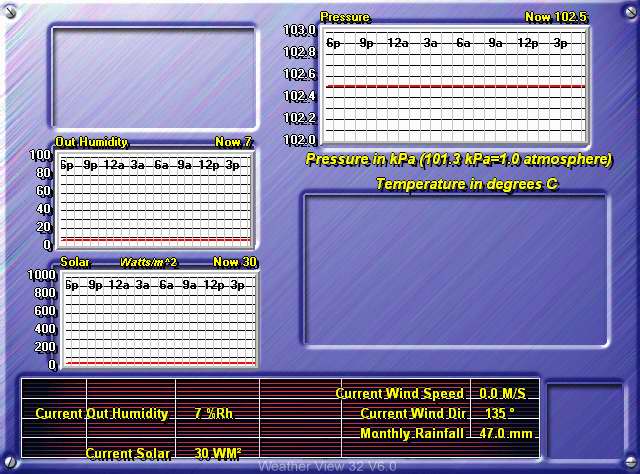
The image to the right is the readout from the
Texas Weather Instruments WRL-32S weather station located on the top of
Curie Hall.
|
Temperatures below are in degrees Celsius.
|
|||||||||||||||||||||||||||||||||||||||||||||||||||||||||||||||||||
![]()
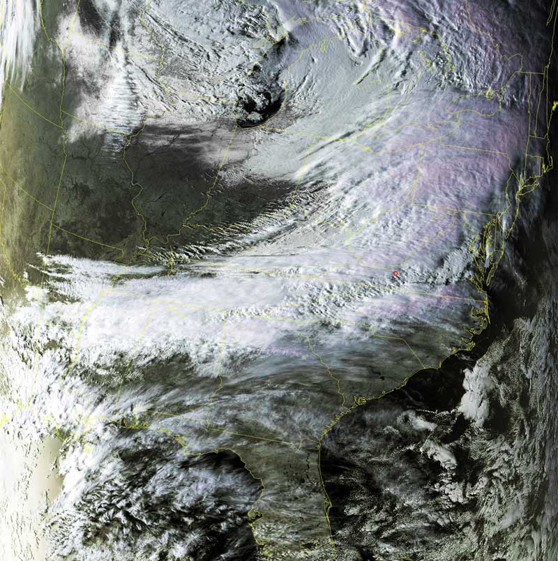
Satellites: NOAA-15, NOAA 16, NOAA 17 and NOAA-18, part of NOAA's 850km-high (530 mile-high) Polar Orbiting satellites
Cold front coming through
The classic scenario for a cold front meeting a warm, wet packet of air.
The clear section in the midwest shows the cold air that has come down from higher latitudes.
That cold air met up with the warmer, humid air coming up from the Gulf of Mexico.
These two masses of air met along the Appalachian Mountains as shown in this image.
The result was a bit of snow, ice and rain all along the backbone of the Appalachian Mountains.