![]()
|
|
|
|

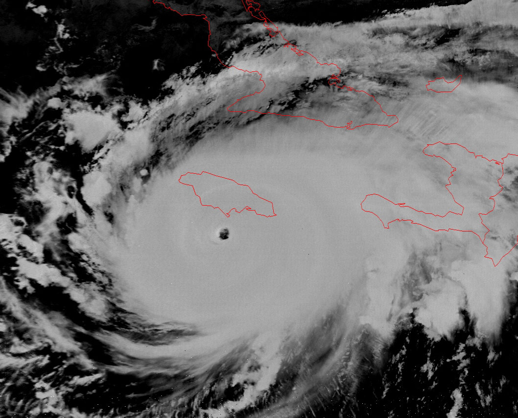
Satellite: NOAA-17,
one of NOAA's 850km-high (530 mile-high) Polar
Orbiting satellites.
Image taken last night, Sept. 10:
Flyover beginning 11:03pm EDT 9/10/04
Hurricane
Ivan at night
The eye of
Hurricane Ivan passes just south of
Jamaica.
Click here for a closeup image of Ivan clearly showing the eye of the hurricane
just south of Jamaica.
In the higher-resolution image of the eye, you can even see a
bit of the structure of the powerful eyewall, where the strongest of the winds
occur.
You can also see the classic spoke structure showing Ivan still drawing power
from the warmth of the ocean.
This image was made using two of the infrared (channels 4 and 5, with
wavelengths greater than 750 nanometers) channels on NOAA-17. At night, the
visible channels (1 and 2) are simply blacked out.
You can see from the previous few
"Images of the Day" that Ivan
is heading for the western end of Cuba.
Ultimately, Ivan will turn north and hit the US around the Florida panhandle.
If Ivan travels over this narrow end of Cuba, then he will not dissipate as much
energy as he would if he traveled over the wider part of the island.
Storm-weary Cuba and the Caribbean US can hope that Ivan does not draw too much
energy from the warm waters of the Gulf of Mexico.
Click on the image below for a higher-resolution (>170k) version.