
Virginia's Rivers (Part 9)
Big Sandy System
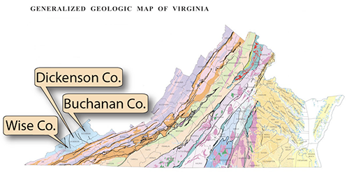
• The upper tributaries of the Big Sandy River system drain the Applalachian Plateaus counties of primarily Wise, Dickenson, and Buchanan.
• The major rivers of the Big Sandy system in Virginia are Russell Fork with its main tributary, the Pound River.
• Russell Fork, at Breaks Interstate Park, has cut a spectacular gorge into the flat-lying bedrock layers of the Appalachian Plateaus. For more information, click here.
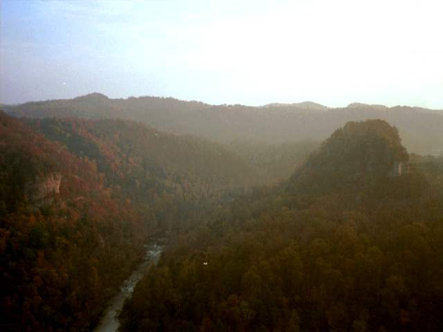
Breaks Interstate Park and Russell Fork in Dickenson County, near the Kentucky border. (Photograph by Phyllis Newbill)
• Russell Fork moves northward, crossing out of Virginia into Kentucky, where it becomes Levisa Fork. Where it joins Tug Fork, it becomes the Big Sandy River which forms part of the boundary between Kentucky and West Virginia.
• The Big Sandy reaches the Ohio River at Catlettsburg, Kentucky at the tri-state boundary of Kentucky, West Virginia, and Ohio.
***End Physiography***