
Coastal Plain, General Physiography, Part 4
Drainage
• Coastal Plain streams have a dendritic pattern, and flow generally oceanward toward the southeast.
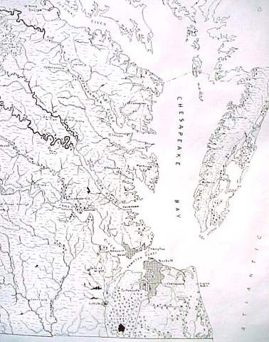
The dendritic or branching pattern of these Coastal Plain rivers indicates a lack of geologic features that might direct the streams in other directions. Tidewater streams simply flow southeastward down the regional slope. [Map courtesy of the Virginia Division of Geology and Mineral Resources]
• Six major rivers drain the Coastal Plain in Virginia: Potomac, Rappahannock, York (formed by the Mattaponi and the Pamunkey), and James.
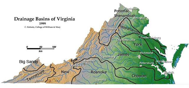
Map of Virginia’s major drainage basins. Note how Coastal Plain rivers generally flow southeast. [Image from College of William & Mary geology website, courtesy of C. M. Bailey]
• The southernmost part of the Coastal Plain is drained by streams that flow into the Chowan River, a North Carolina stream that flows into Albemarle Sound.
• Because the Coastal Plain has low topographic relief, drainage is generally poor. Numerous marshes and swamps are present.
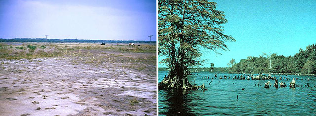
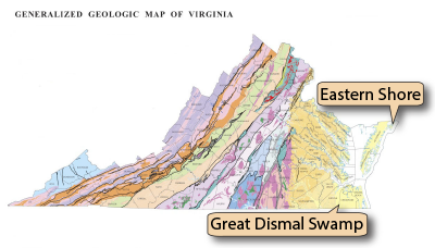 Marshes and swamps are present throughout the Coastal Plain. Shown here is an example of a tidal marsh on the Eastern Shore (above left) and the Great Dismal Swamp (above right).(Left photograph by Stan Johnson, right photograph courtesy of the Virginia Division of Geology and Mineral Resources)